

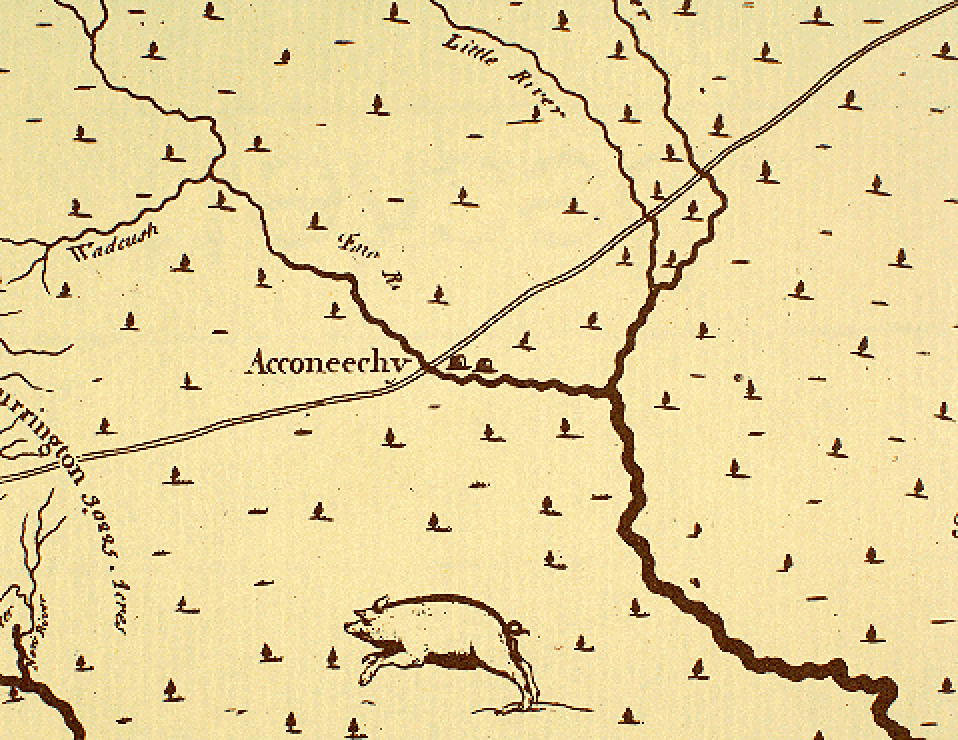
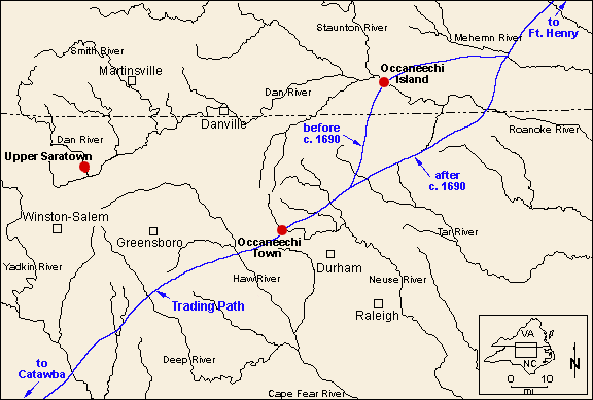
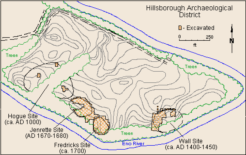
Although the ethnohistoric record contains little precise information on the locations of Siouan towns, a description in John Lawson's journal (Lefler 1967) and the survival of "Occaneechi" as a place name provide a strong case for locating the 1701 town of Occaneechi immediately southeast of present-day Hillsborough in Orange County, North Carolina (Rights 1957; Lefler 1967). This case is strengthened further by Edward Moseley's 1733 map of North Carolina which places "Acconeechy" just east of the Great Trading Path on the north side of the Eno River. A reconstruction of this path's route through piedmont North Carolina has shown that it crossed the Eno River at Hillsborough (Rights 1931). Finally, the Eno River floodplain just east of Hillsborough, formed by a bend in the river's course, comprises the only large (ca. 25 acres) expanse of land in the vicinity that would have been suitable for native agriculture (see map of Hillsborough archaeological district).
When the Wall site was first investigated archaeologically during the late 1930s and early 1940s, it was reasonably thought to be the remains of Lawson's Occaneechi Town because of its location and presumed late date of occupation (Coe 1952). This interpretation was generally accepted until the inception of the Siouan Project in 1983. At that time, a cursory re-examination of the 1938-1941 excavation data immediately called to question this interpretation. It was felt that, given the Occaneechis' active participation in the deerskin and fur trade with the Virginia colony and the comparatively late date for Occaneechi Town, the archaeological remains of that community should contain numerous European-made artifacts. However, most of the European and Euroamerican artifacts found at the Wall site either dated too late or had been found in disturbed contexts. Because of this, it was felt that additional field investigations were needed to clarify the chronological placement of the Wall site and to critically evaluate its identification as Occaneechi Town.
A Second Look at the Wall Site
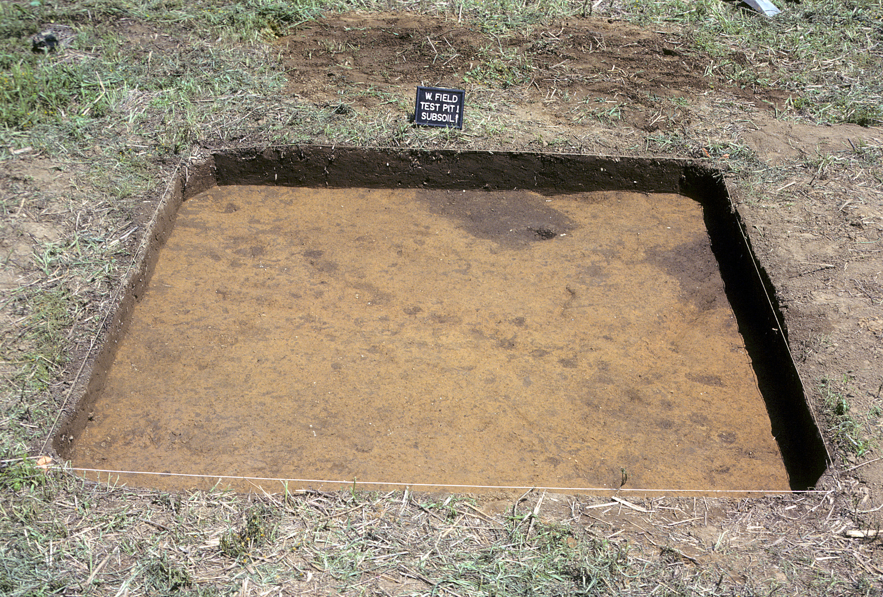
In the summer of 1983, excavations were resumed at the Wall site. Initially, sections of the old 1938-1941 excavations were isolated and a site grid was re-established. A portion of the rich midden surrounding the village was excavated and subjected to fine-scale recovery techniques. In addition, three burials were excavated and portions of two circular house patterns were exposed. The few European and Euroamerican artifacts found were from plow-disturbed soil, and most of these dated to the latter half of the eighteenth century or early nineteenth century, well after the time when Occaneechi Town was occupied. Just as important, no European artifacts were found in undisturbed contexts despite careful waterscreening through 1/16-inch mesh. Radiocarbon dating provided additional evidence that the Wall site village predated the period of European contact. Three radiocarbon samples from undisturbed contexts yielded an average corrected date of A.D. 1545+/-80 years [not calibrated]. These data, in conjunction with a review of the earlier investigations, led to the irrefutable conclusion that the Wall site was too old to be historic Occaneechi Town.
Discovering the Fredricks Site
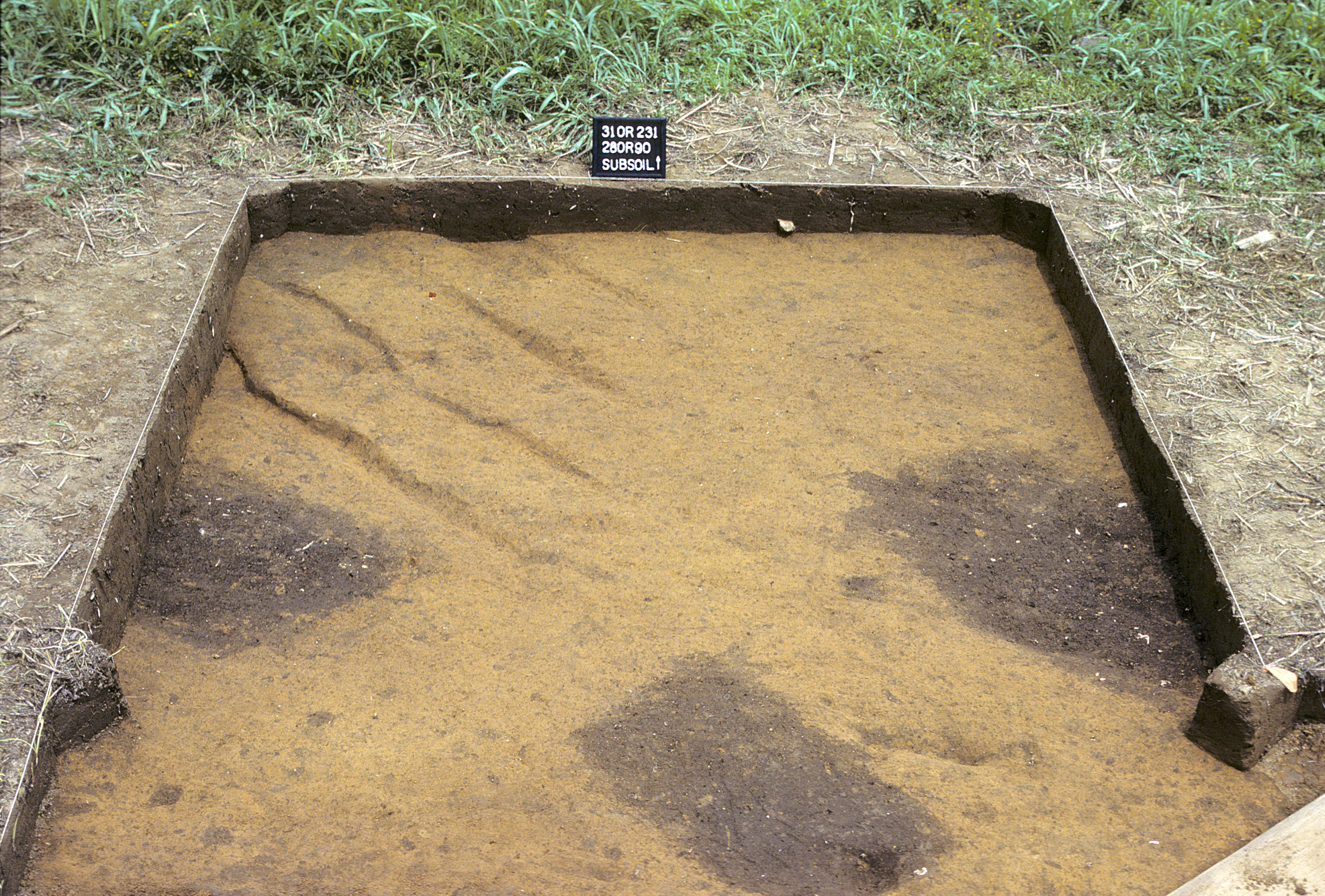
During initial surveys to relocate the Wall site in the spring of 1983, two other village sites were discovered nearby. At one of these, the Fredricks site, several European artifacts, along with Indian-made pottery fragments, were found on the surface. Once it appeared that the Wall site was not Occaneechi Town, UNC archaeologists dug several shovel-sized test pits on this newly discovered site in the hope of finding evidence for intact archaeological deposits. One of these small test pits exposed the top edge of a pit filled with refuse and dark soil. This discovery was followed by the excavation of eight contiguous 10-ft x 10-ft squares. These revealed five sharp-cornered rectangular pits (see excavated square) and a line of small postholes (see excavated square). Both the posthole pattern and the pits were neatly arranged in a northwest-southeast direction. (See video clip describing the discovery of Occaneechi Town [available video formats: Quicktime, MPEG-1, MPEG-4, RealPlayer.]).
Four of the pits were excavated, and three contained human skeletal remains accompanied by grave goods of both European and Indian manufacture. The fourth pit, identical in shape to the other three, appeared to represent a burial but contained no bones or grave goods. Two of the burials were the remains of children between three and eight years old at death. Included with these burials were European trade items such as knives, scissors, and a variety of glass beads. Aboriginal artifacts included shell gorgets, shell beads, and a ceramic vessel. One adult male burial contained a wealth of European artifacts, including an intact rum bottle, scissors, knives, a pewter pipe and buttons, a pair of ember tongs, and an iron axe head.
Most of the trade artifacts from these burial pits dated to the late 1600s or very early 1700s, the appropriate period for Occaneechi Town. Archaeological finds from subsequent investigations at the site confirmed this initial chronological assessment. The site appeared to be well preserved, with no evidence of disturbance other than shallow plowing. From these observations, it became obvious that more intensive work was needed at the Fredricks site. Hence, plans were immediately begun for a project in 1984 that would combine a major excavation and testing program at the Fredricks site, along with continued work at the neighboring Wall site.