

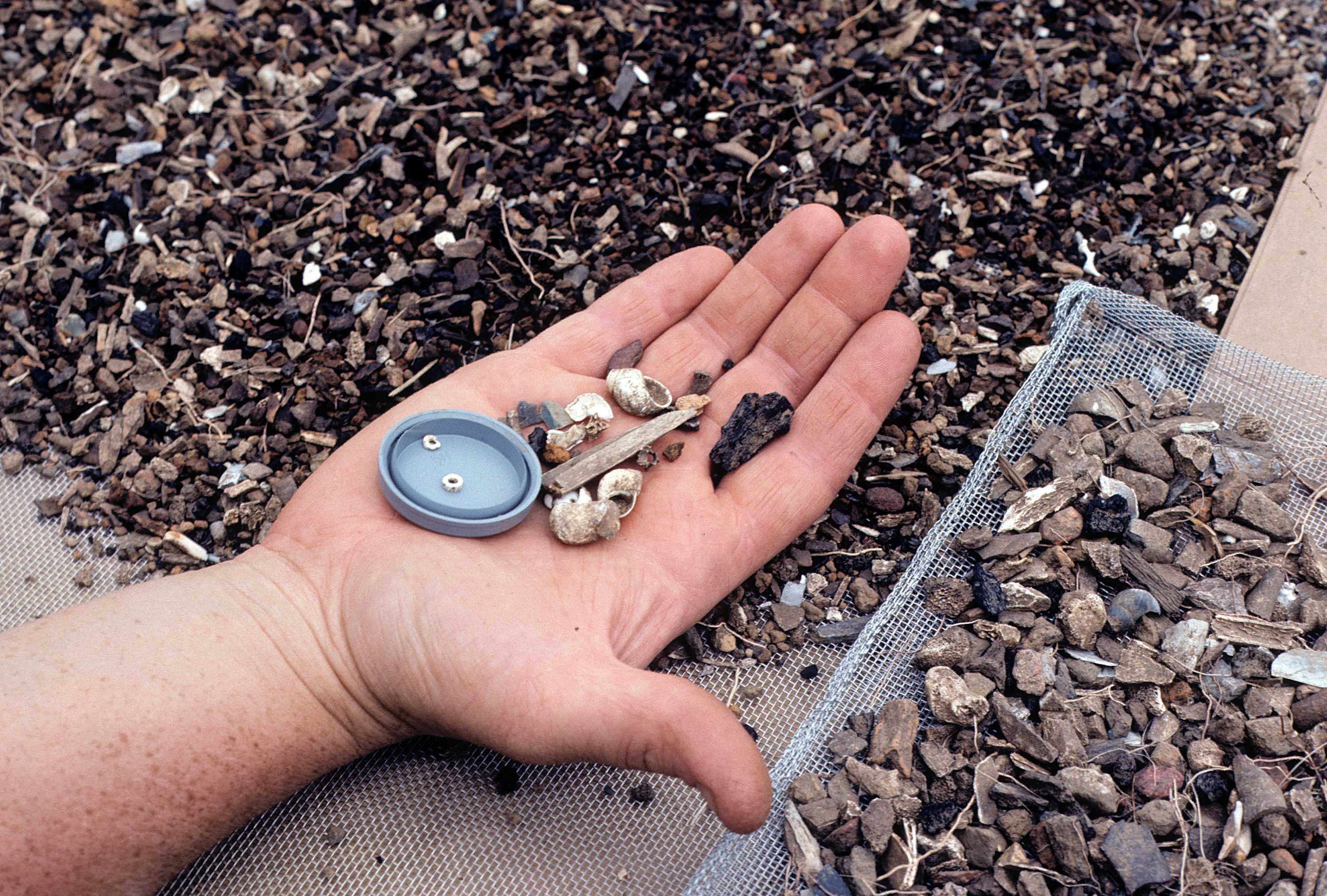
Because the Fredricks site was discovered late in the 1983 field season, investigations that summer were relatively brief. A limited excavation of 800 sq ft revealed a portion of a cemetery lying just outside the village (see photo) and a segment of the village palisade (see photo). Three human burials within the cemetery were excavated. All three pits were rectangular with sharp corners (indicating that they probably were excavated with metal tools) and contained numerous artifacts of Euroamerican manufacture. A fourth pit excavated within the cemetery contained neither human remains nor grave associations (see photos of sifting plowed soil, burial excavation).
A second field season at the Fredricks site, conducted during the summer of 1984 and sponsored by the National Geographic Society, uncovered a much larger area of the cemetery and the adjacent village (Dickens et al. 1984, [ed.] 1987) (see aerial view of Wall and Fredricks site excavations; see aerial view of Fredricks site excavation). These investigations were designed to obtain additional data on mortuary behavior and to begin sampling domestic areas. In addition, systematic subsurface testing was undertaken on unexcavated portions of the site to delimit probable site boundaries and to make a preliminary assessment of internal site structure.
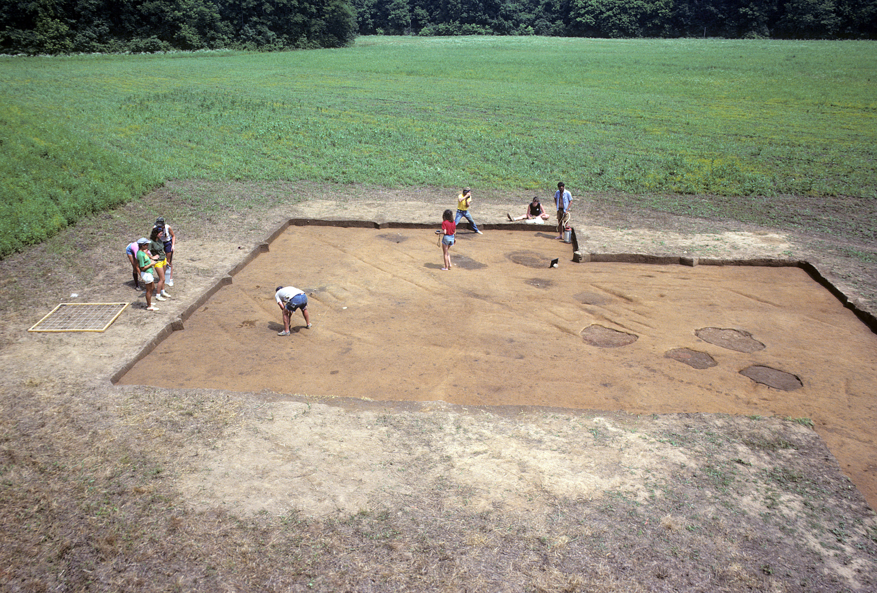
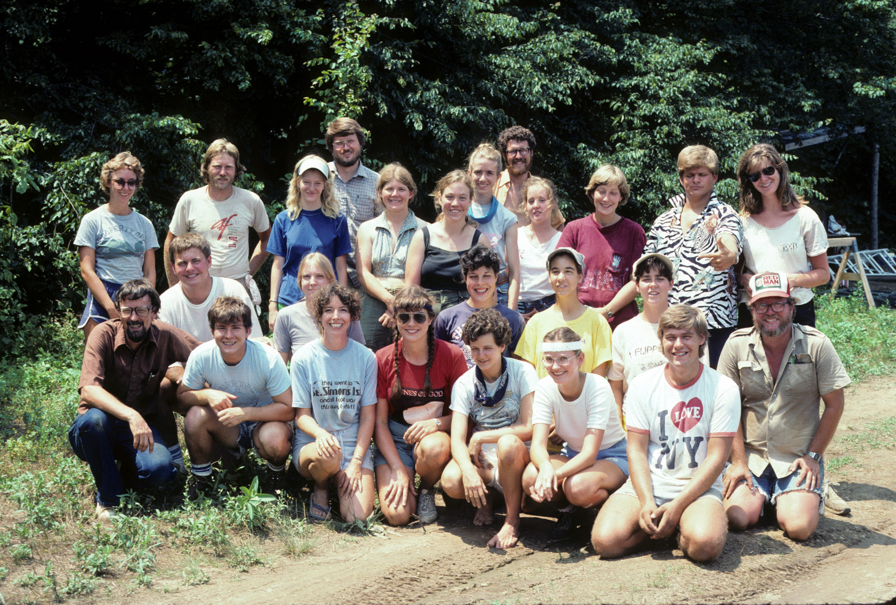
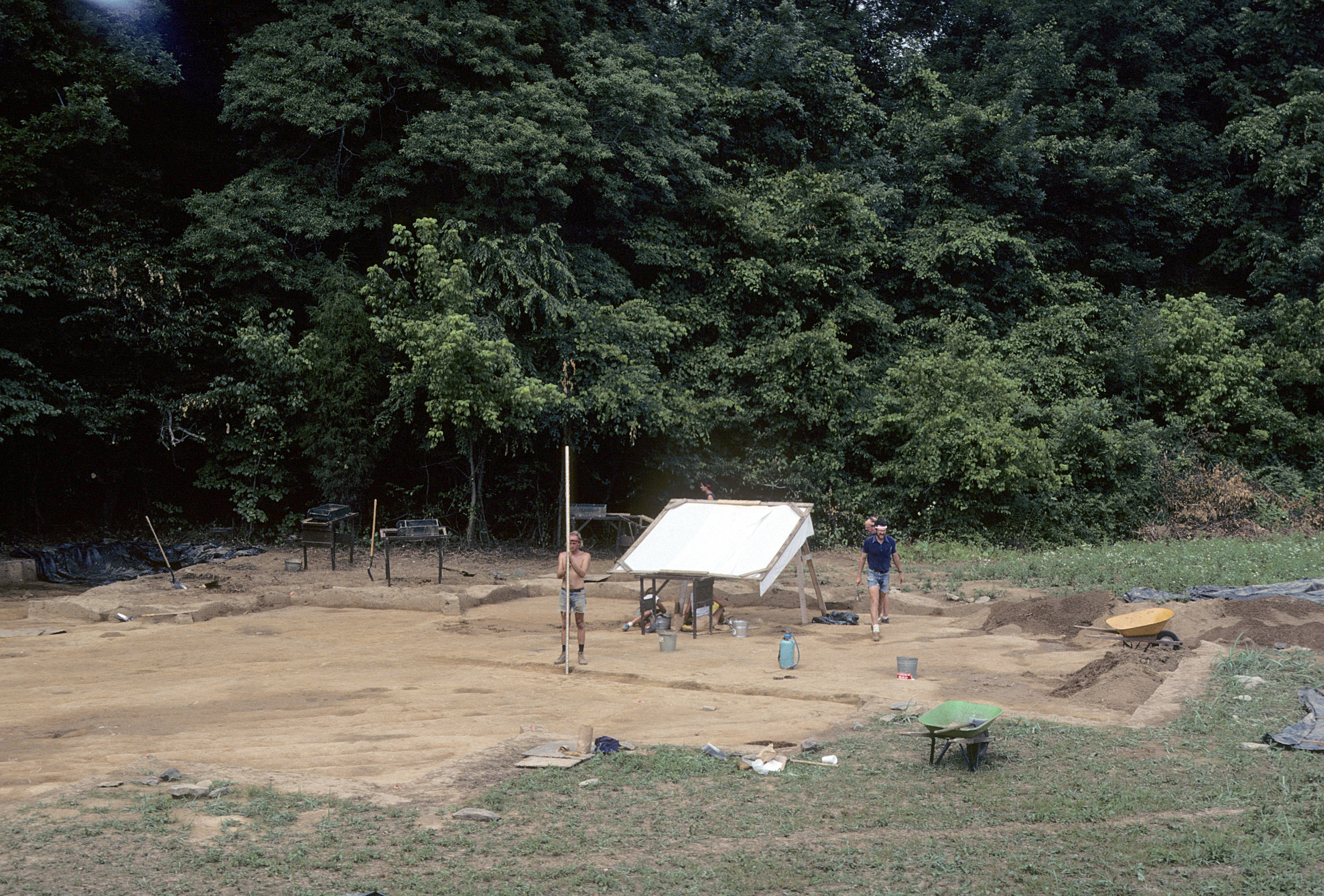
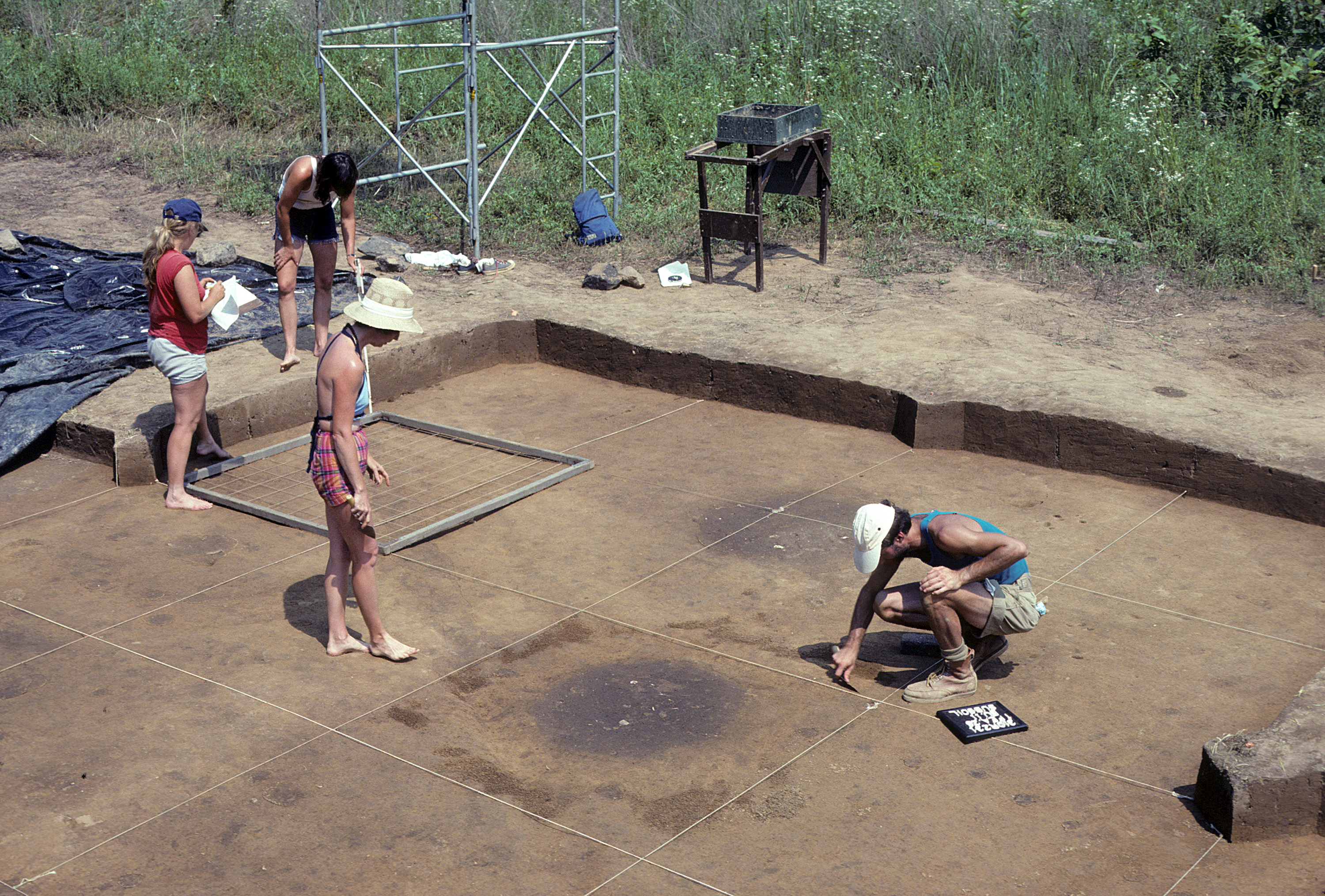
During 1984, 27 new 10-ft by 10-ft units (2,700 ft2) were excavated, and six of the eight units excavated in 1983 were re-exposed (see general view of excavation). These excavations uncovered six additional burials within the cemetery, a 90-ft palisade segment, and approximately 2,250 ft2 of the village area inside the palisade (see cemetery, burial excavation). Mapping of postholes revealed two complete domestic structures. In addition, an oval, wall-trench sweat lodge with an interior fire pit was exposed in the southwesternmost corner of the excavation (see sweat lodge). Subsurface testing of unexcavated areas consisted of auger sampling at 2.5-ft intervals to identify archaeological features. This procedure proved to be highly reliable and was successful both in delimiting the remainder of the cemetery and in identifying areas of intensive domestic activity within the village. It was somewhat less effective, however, in providing a precise definition of site boundaries (see Davis and Ward 1987) (see 1984 crew).
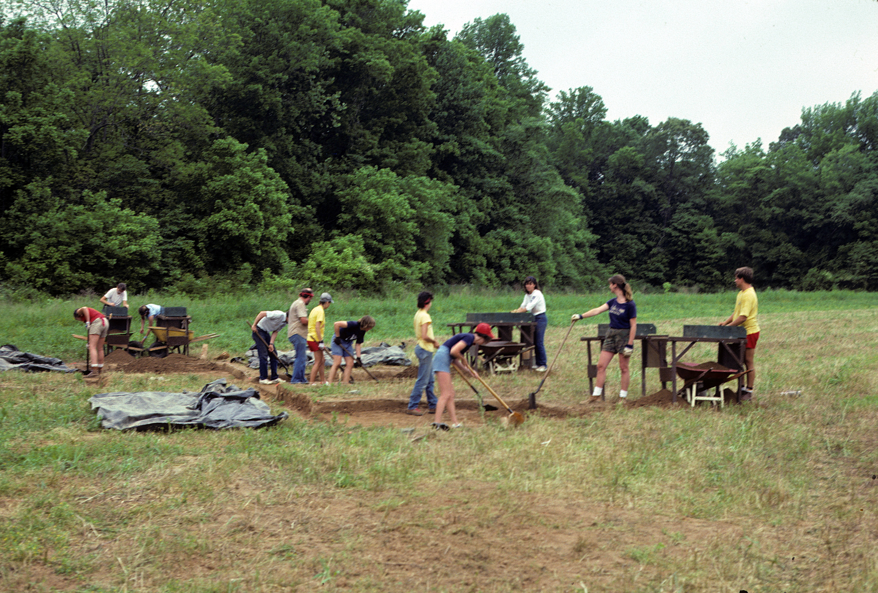
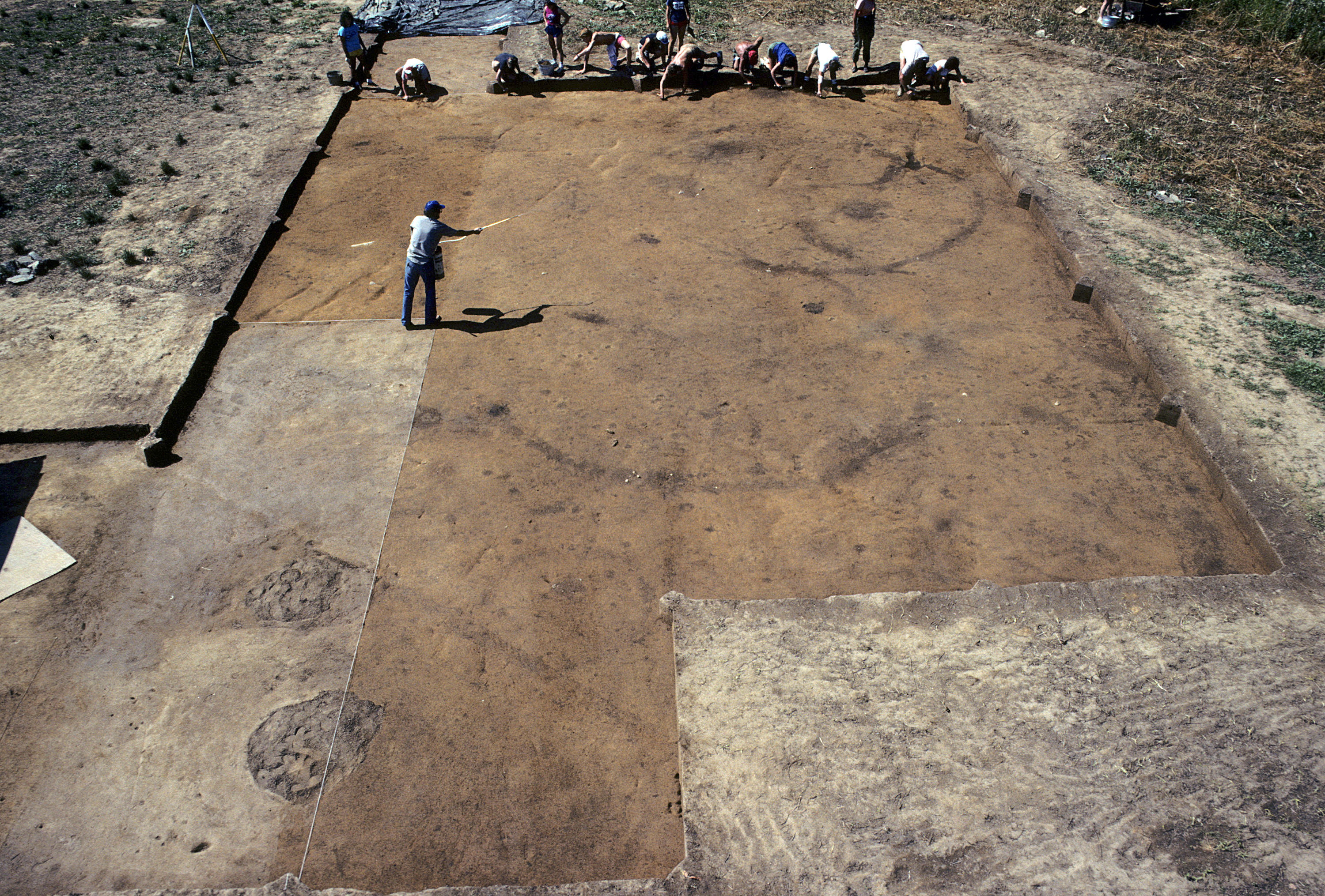
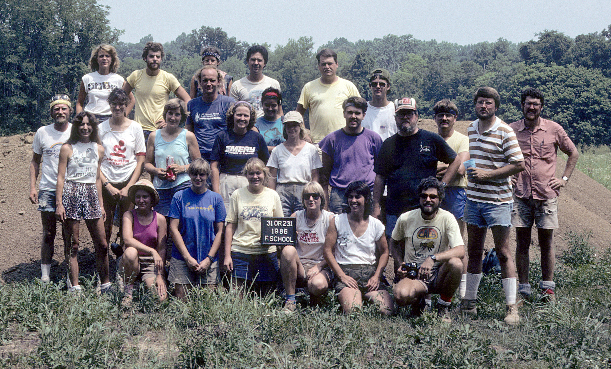
In 1985, a third season of fieldwork was made possible by additional funding from the National Geographic Society (Dickens et al. 1985; Dickens et al. [ed.] 1986). These excavations exposed 62 10-ft by 10-ft units, more than doubling the total area uncovered during the previous two field seasons (see general view of excavation). The large excavated area made it possible to estimate the overall size of the village as well as to predict its internal spatial configuration. Twenty-five features and three burials were excavated (see feature excavation). The burials were the last remaining in the cemetery, bringing the total to 12 with an additional probable burial. Six new structures also were defined as a result of the 1985 work, and approximately 100 ft of the palisade were exposed as it continued to encircle the habitation area (see cleaning house patterns). At the end of the 1985 field season, it was estimated that the village compound within the palisade was small, comprising only about .25 acres. A total of 11-12 houses were estimated to have sheltered approximately 50-75 individuals (see 1985 crew).
The 1986 excavation at the Fredricks site uncovered all the remaining village area enclosed within the palisade except for a small section in the southwest corner where large trees prevented soil removal (see general view of excavation). Although still small, the village shape was more irregular than predicted after the 1985 field season. The irregular outline resulted from the fact that the palisade "bowed-out" or expanded to the southwest, thus creating a D-shaped rather than oval configuration. Although much of the structural evidence continued to consist of vague posthole clusters, two additional wall-trench structures were defined and the 13 pit features associated with the structures were extremely rich. Their depositional character and contents added significant new data that aided in clarifying general as well as specific behavioral patterns within the village. In addition, two human burials, two possible burial pits, a possible hearth, and an irregular trench were excavated. Another probable pit (Feature 60) and a shallow basin (Feature 52) were mapped but not excavated (see 1986 crew).
In 1995, while excavating the nearby Jenrette site, Feature 60 and the three final 10-ft by 10-ft units at the Fredricks site were excavated.
For a map showing the area excavated during each field season, click here.
Field Methods
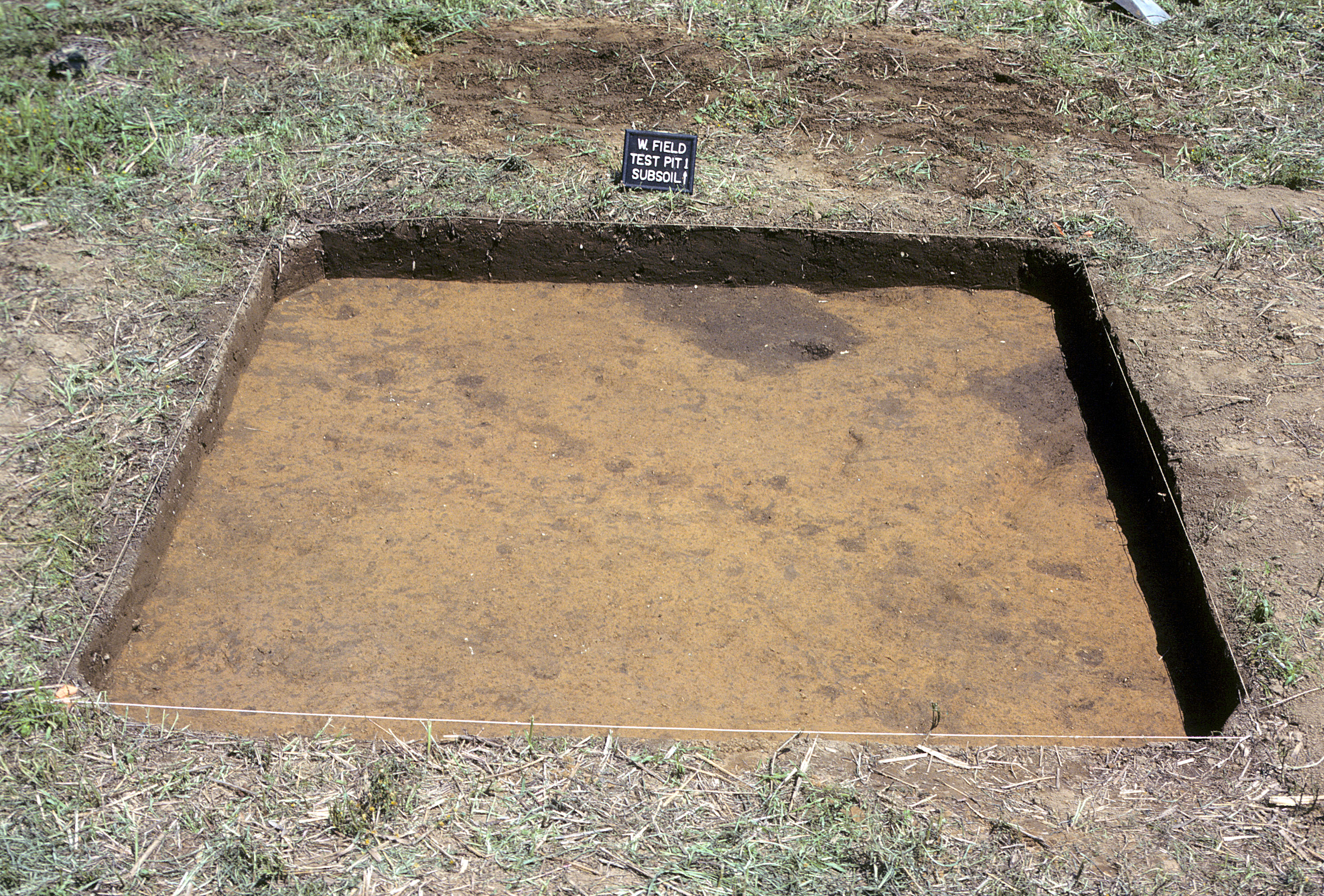
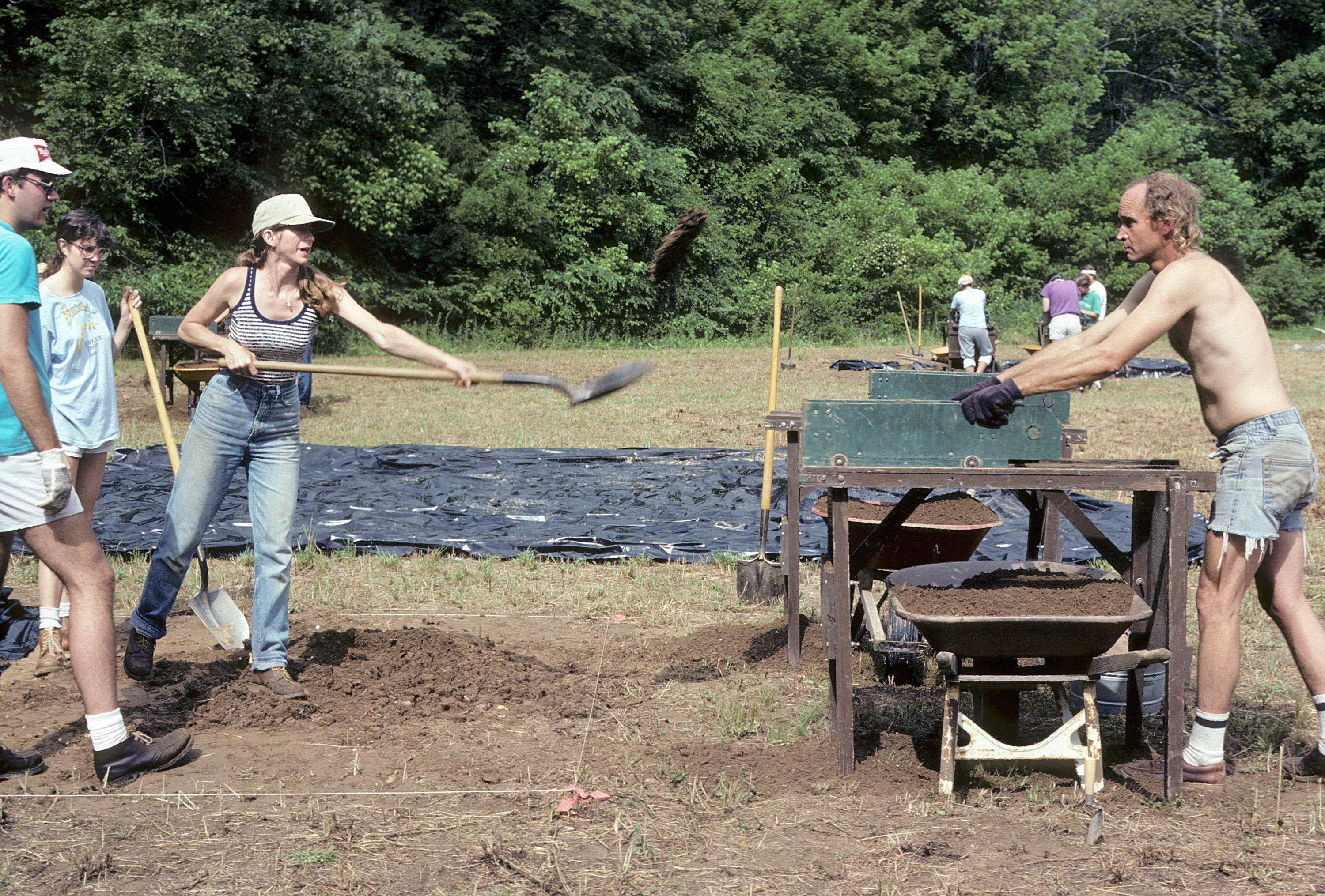
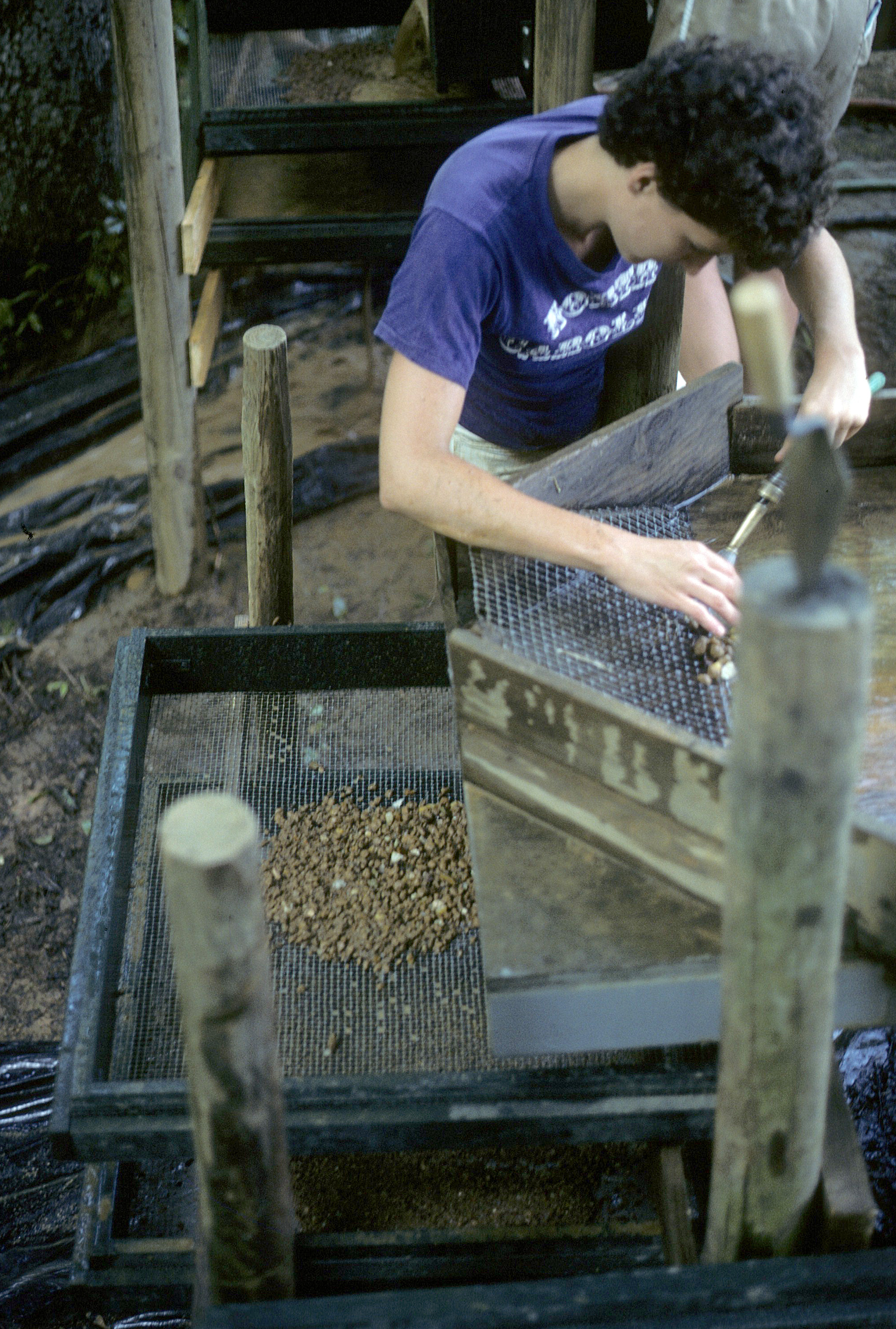
Archaeological field methods were consistent throughout all field seasons at the Fredricks site. Each season, preliminary site preparation consisted of bushhogging the work area and re-establishing the site grid and reference point for elevations. All plowzone (0.5-1.6 ft thick) was excavated in 10-ft by 10-ft units, with soil being dry screened through 1/2-inch wire mesh using hand sifters. A 20-liter soil sample from the plowzone of each unit was waterscreened through 1/16-inch mesh to assess small artifact content.
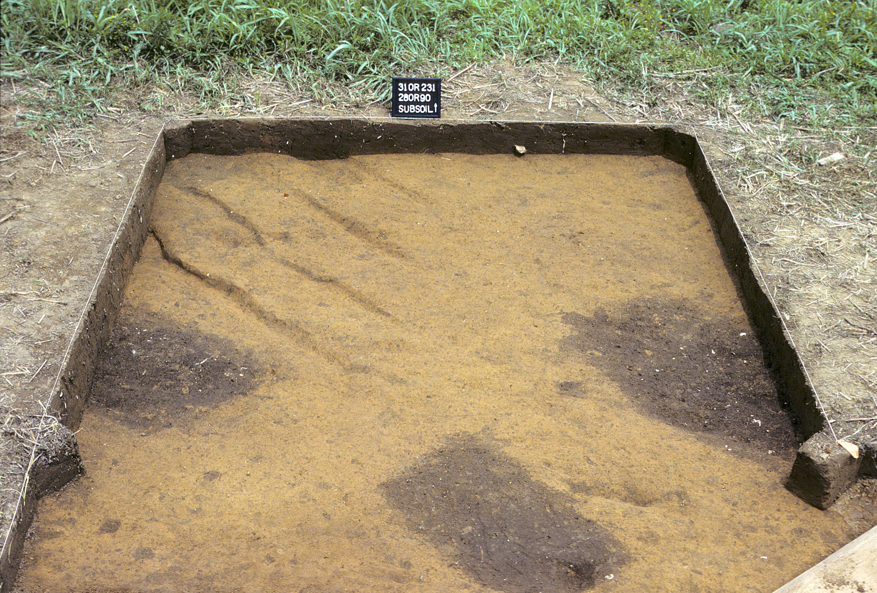
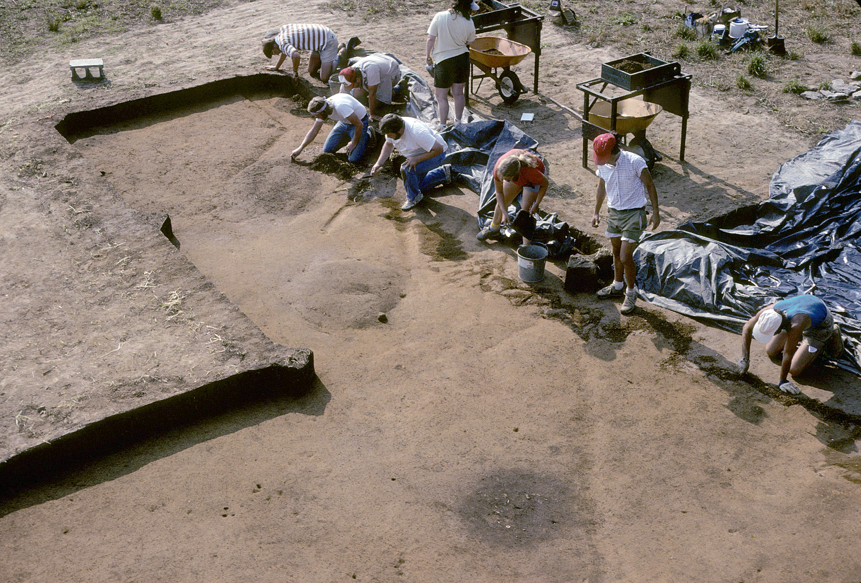
Following the removal of plowzone, the bottom of each excavation unit (top of subsoil) was carefully trowelled in order to identify and record pits and postholes. The trowelled surface was documented by black-and-white and color photographs and was mapped at a scale of 1 in=2 ft. The drawings of each excavation unit were subsequently combined to produce an overall plot of the excavation. Photographs were also made of all procedures and of the general progress of work. Horizontal and vertical control was maintained through reference to the site grid, using a transit and leveling rod to determine elevations.
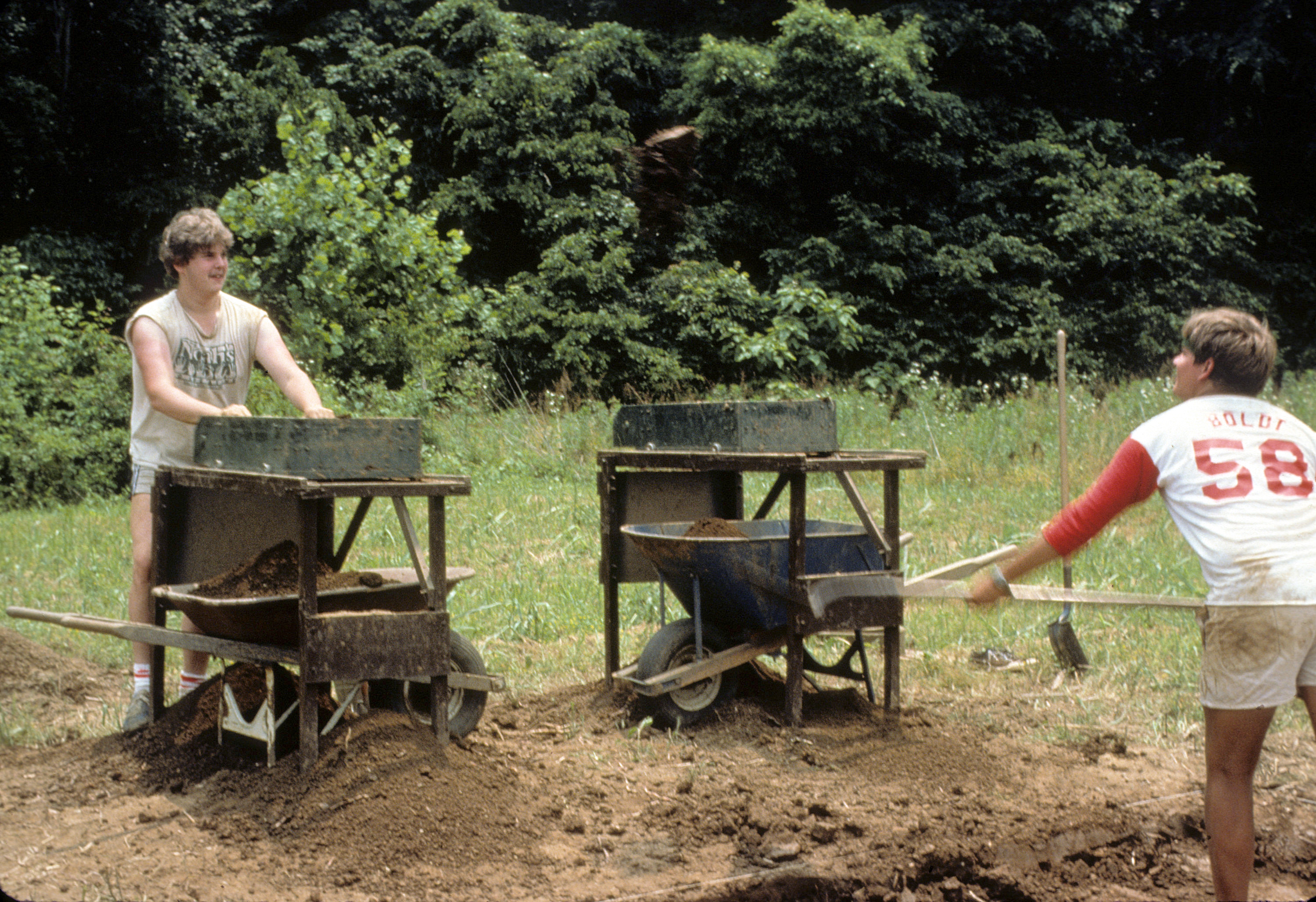
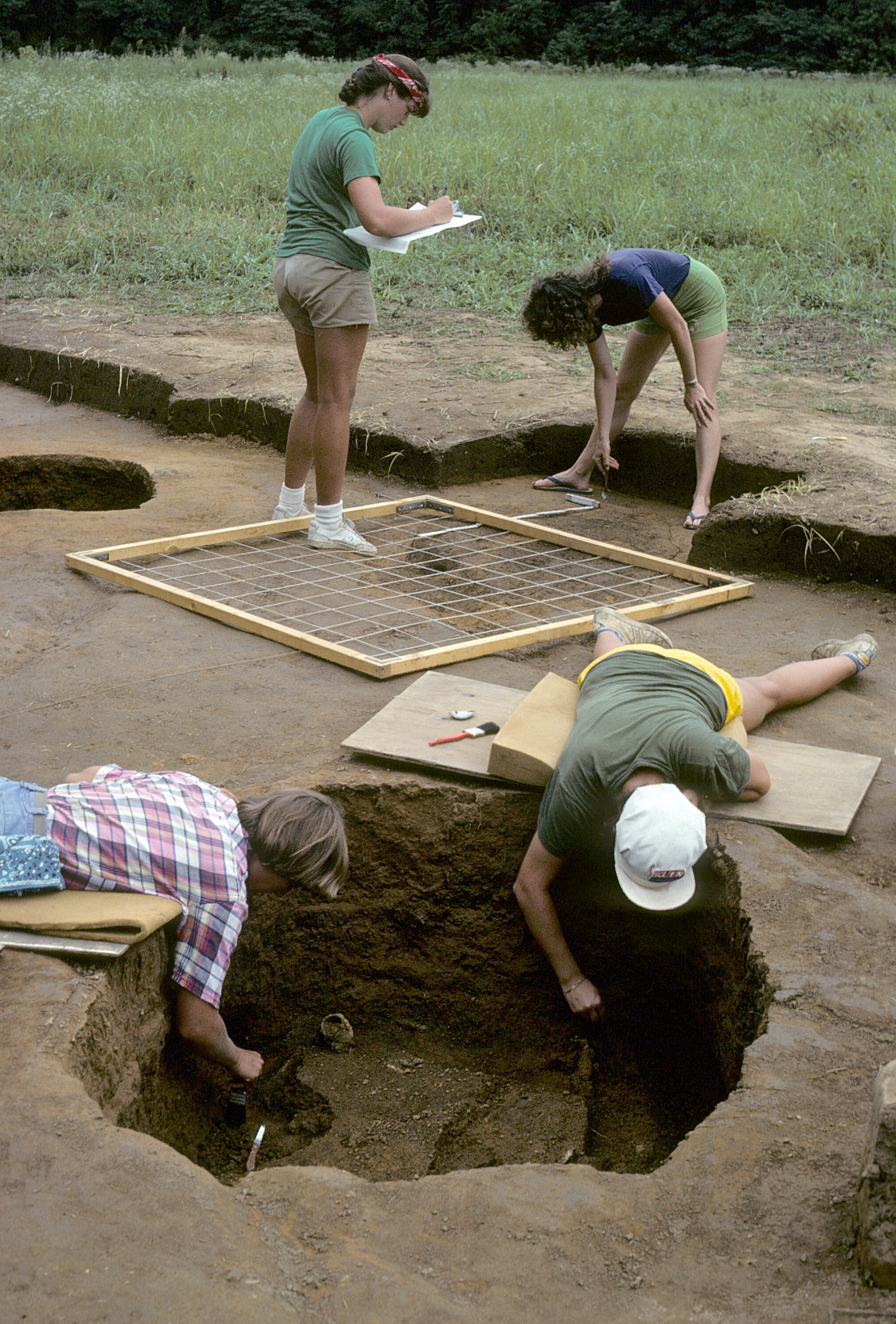
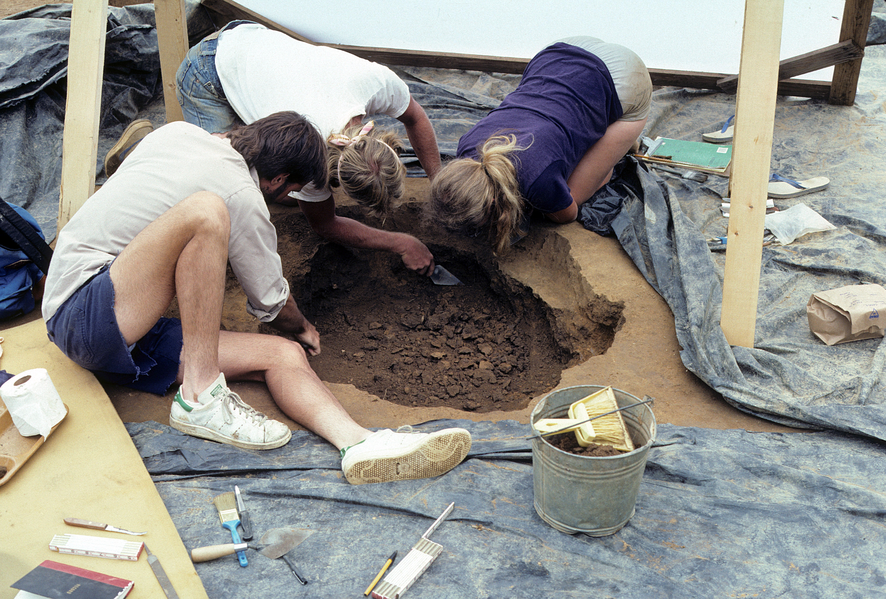
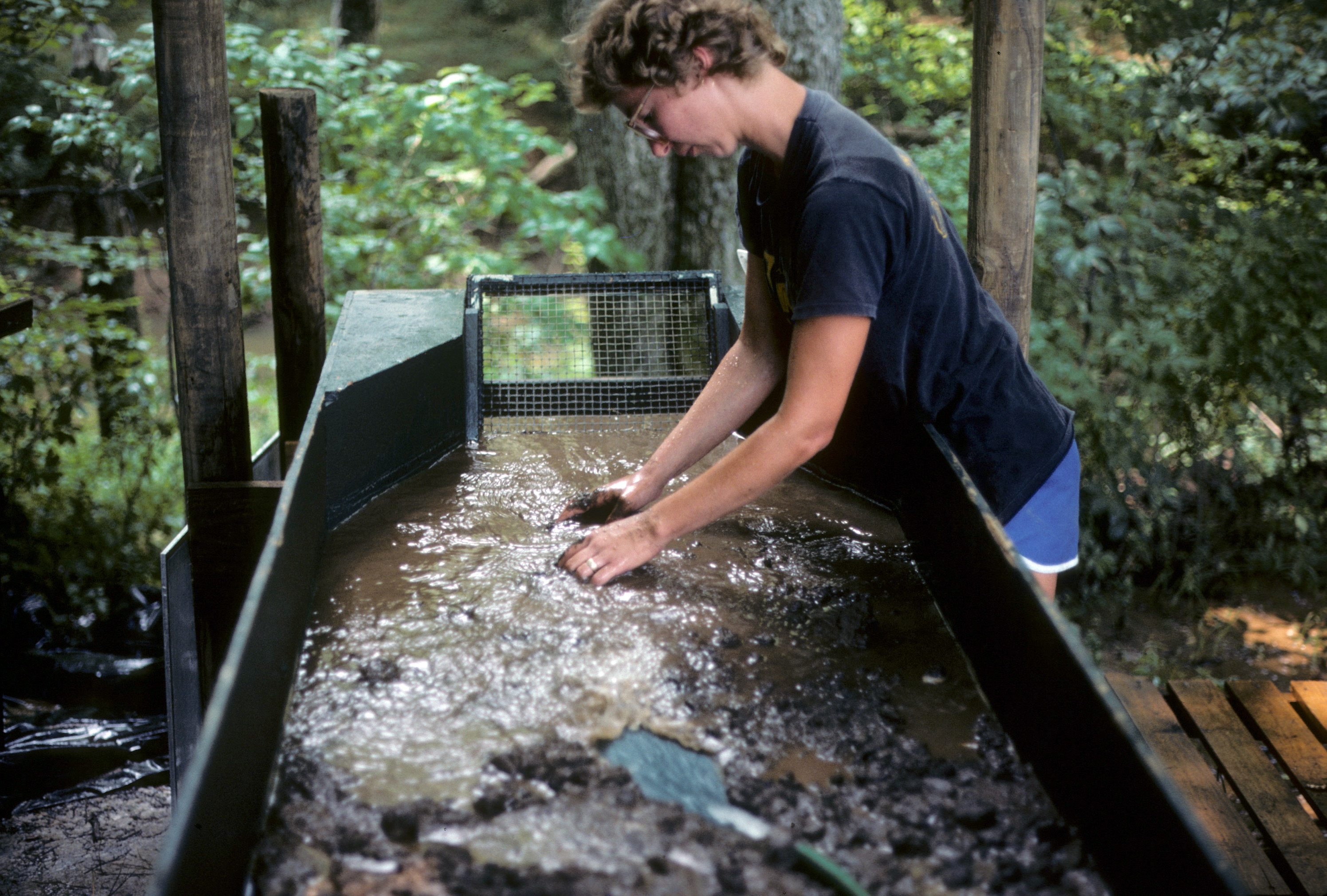
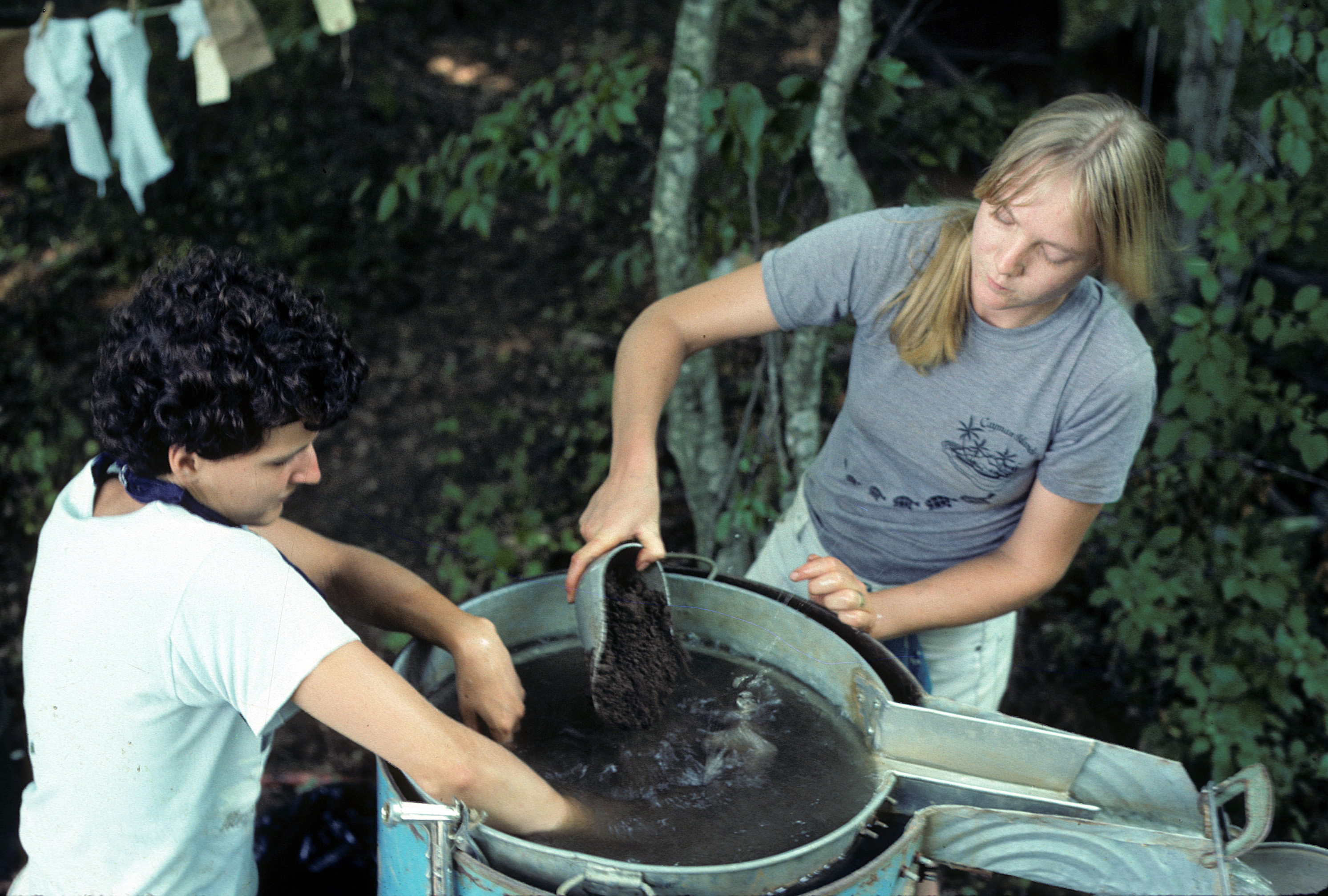
Excavation of features and burials was accomplished using trowels, grapefruit knives, brushes, and other small tools. Sunscreens, constructed of wooden frames and bedsheets, were erected over features during excavation to minimize the damage to feature contents by the summer sun. Feature fill was removed in natural zones, when evident, and all fill was waterscreened through sluice boxes having a sequence of 1/2-inch, 1/4-inch, and 1/16-inch screens. This technique permitted the recovery of minute artifacts, including shell and glass beads, lead shot, small animal bones, and carbonized plant remains. Standard 10-liter soil samples from each zone of each feature were simultaneously processed by flotation to retrieve very small, extremely fragile carbonized seeds and plant parts that might otherwise be lost in the waterscreening. Elevations were taken following the removal of each soil zone of a feature in order to establish precise provenience for zone contents and to permit the calculation of soil volume.
After completion of excavation, all features and burials were extensively documented by black-and-white and color photography, and by drawings in profile and plan at a scale of 1 in=1 ft. Also, extensive notes were kept by all excavators in both field journals and on standardized feature and burial data forms.
Following completion of each field season, the excavation was immediately backfilled using a front-end loader.