Excavation Units

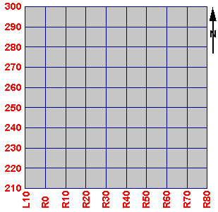
Each block in the checkerboard pattern shown here also happens to be an excavation unit, 10 by 10 feet in size, called a square. Each square is named after the grid coordinate of its southeast corner. Moving your mouse over the excavation map displays the square name in the box below. Notice how the names change in accordance with the grid. Because north is at the top of the map, each square's name is taken from its lower-right corner.

Square Name:   
290R0 290R10 290R20 290R30 290R40 290R50 290R60 290R70 290R80 280R0 280R10 280R20 280R30 280R40 280R50 280R60 280R70 280R80 270R0 270R10 270R20 270R30 270R40 270R50 270R60 270R70 270R80 260R0 260R10 260R20 260R30 260R40 260R50 260R60 260R70 260R80 250R0 250R10 250R20 250R30 250R40 250R50 250R60 250R70 250R80 240R0 240R10 240R20 240R30 240R40 240R50 240R60 240R70 240R80 230R0 230R10 230R20 230R30 230R40 230R50 230R60 230R70 230R80 220R0 220R10 220R20 220R30 220R40 220R50 220R60 220R70 220R80 210R0 210R10 210R20 210R30 210R40 210R50 210R60 210R70 210R80