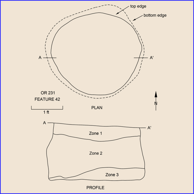
Type: Pit
Dimensions
Length: 3.0 ft
Width: 3.0 ft
Depth: 1.8 ft
Volume: 16.20 ft3
Area: 9.00 ft2

Related Contexts:
by H. Trawick Ward
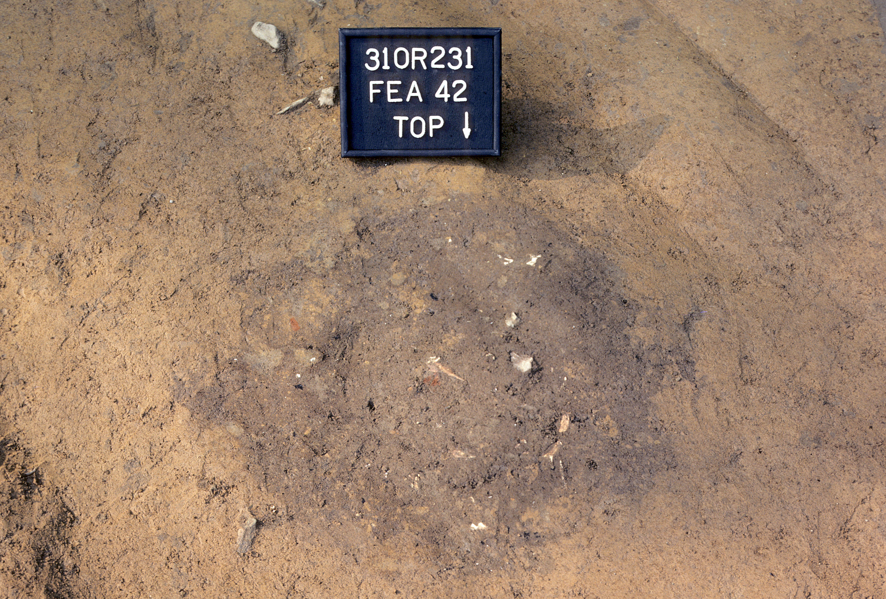
Feature 42 was located near the southeastern edge of the palisaded village at 198.0R73.0. A circular stain of dark gray soil mottled with charcoal and burned clay flecks (designated Zone 1) defined this pit at the base of the plowzone. Also noted at the pit surface were numerous animal bones and rock fragments. Two gunflints and several glass beads were also recovered from Zone 1, which had a maximum thickness of about 0.5 ft.
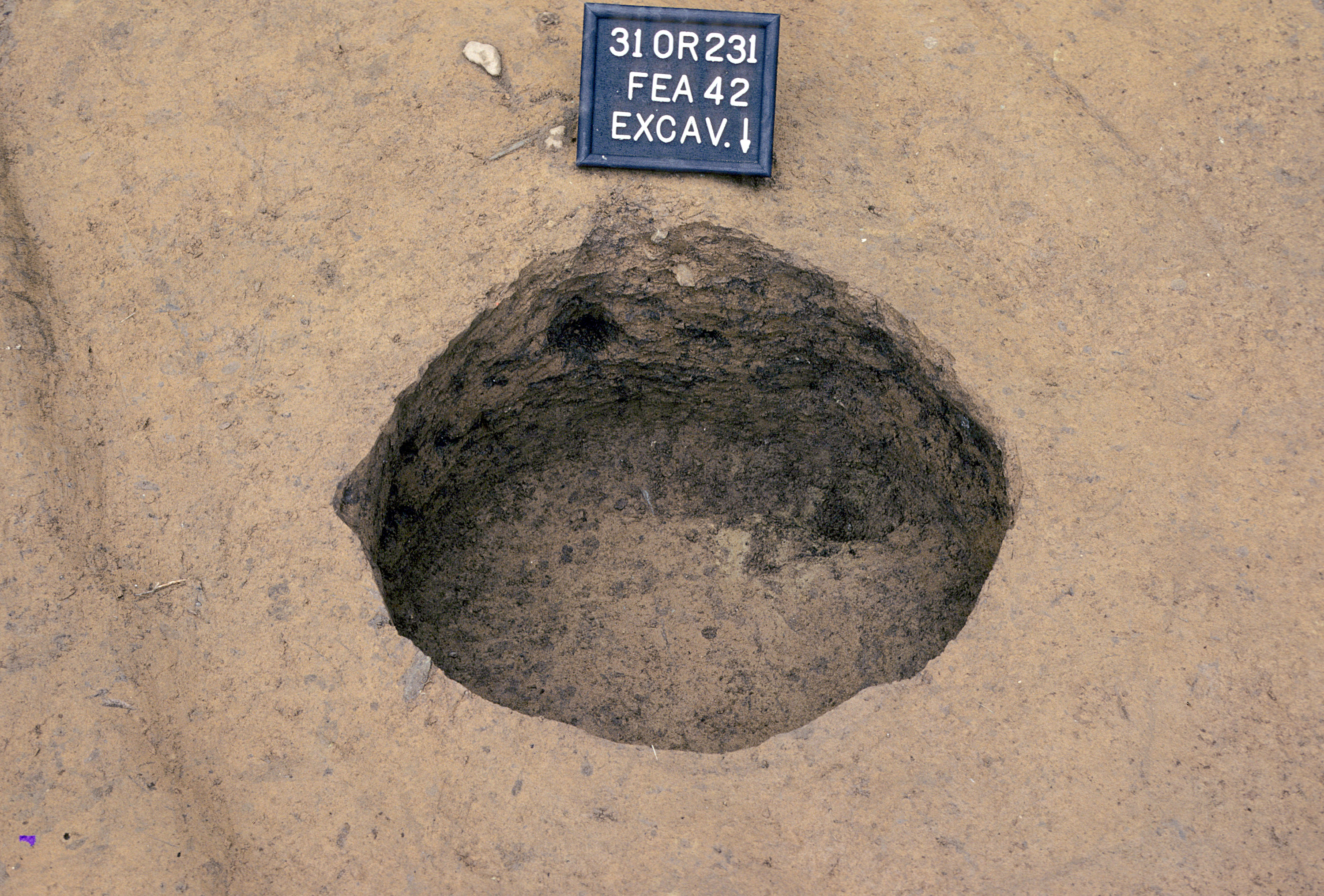
At the base of Zone 1, a gray ashy soil (designated Zone 2) was encountered. This zone was noticeably moist and got progressively wetter toward the bottom. It contained numerous animal bones, several aboriginal and kaolin-clay pipe fragments, and one complete "onion-form" clay pipe. Several rocks were also encountered. Zone 2 extended to an average depth of 1.6 ft below the subsoil surface and rested on a thin band of mottled clay and gray soil, designated Zone 3, that contained almost no artifacts. This zone extended to the bottom of the pit, which was reached at a depth of 1.8 ft.
In plan, the feature was circular, measuring approximately 3.0 ft in diameter. The sides bowed out slightly toward the bottom, creating a bell-shaped profile. Apparently, the feature was originally excavated for storage purposes. Given the composition of Zone 3, it appears that after the pit was emptied of its contents, an indeterminate amount of time passed before it was filled with debris. The upper fill zones strongly suggest that hearth areas or other food preparation facilities were cleaned and the resulting refuse used to finish filling the pit. The clay mottling in Zone 1 probably resulted from subsoil slumping into the pit as the fill settled.